

Sensor Integration experience.
Dynamic Aviation specializes in aircraft platform modification and sensor integration, supporting a wide range of advanced mission systems provided by our customers. We work closely with clients and sensor manufacturers to integrate hyperspectral, electro-optical/infrared (EO/IR), LiDAR, and other specialized payloads into our aircraft platforms.
Our team provides the aircraft, structural modifications, power distribution, mounting solutions, data architecture, and operational integration required to successfully deploy customer-supplied sensor systems. With extensive experience integrating complex technologies across diverse mission sets, Dynamic Aviation delivers reliable, mission-ready airborne platforms tailored to each customer’s requirements.
Optech | Aquarius
Optech | Shoals 1000
Optech | Shoals 3000
Optech | CZMIL
Optech | CZMIL Nova
Optech | Galaxy
Optech | Titan
Optech Pegasus HA500
Riegl | VQ-820G
Riegl | VQ-480i
Riegl | LMS-Q680i
Riegl | LMS-Q1560
Sonoma | 474HR3
Sigma Space | HRQLS
Sigma Space | HRQLS2
Sigma Space | HAL
Urban Robotics | PeARL V5
Urban Robotics | Black PeARL
Vision Map | A3
Vision Map | MIST DMC
Wescam | MX-14
Wescam | MX-15
Wescam | MX-20
Wescam | MX-25
LD3 | FLS-AM
LD3 | FLS-AI
Lecia | AHAB Chiropetra II
Lecia | ADS50-II
Lecia | ALS70SU
Lecia | ALS70CU
Lecia | CU80
LOGOS | Leaps OCO
Optech | Orion C300-1
Optech | Orion M300
Optech | Orion H300
Optech | Gemini ALTM
Optech | Gemini ALTM 3100
Optech | ALTM 3070
Optech | Pegasus HA500
Optech | Pegasus HD500
ARGON ST | Daedalus
Azimuth | 36010
BAE | BTS
DRS | Sensor Series 3.1
FLD | xxxxx
FLIR | STAR SAFIRE
HyVista | HyMap
Harris | GmAPD
HIFSA | DMC
Itres | CASI-1500
ITT | MFLL Telescope
Lecia | ADS40
Lecia | ADS80
Lecia | AHAB Hawkeye III

Hyperspectral Sensors
Hyperspectral sensors are remote sensing instruments that capture data across a wide range of the electromagnetic spectrum, typically spanning hundreds of narrow spectral bands. Unlike traditional sensors that record only a few broad wavelength bands, hyperspectral sensors provide detailed spectral information for each pixel in an image. This enables precise characterization of materials and identification of subtle spectral signatures. Hyperspectral imaging finds applications in fields such as agriculture, environmental monitoring, mineral exploration, and defense. It allows for advanced analysis, including vegetation health assessment, crop disease detection, mineral mapping, pollution monitoring, and target identification. By capturing rich spectral data, hyperspectral sensors enable enhanced discrimination and classification of objects and materials. They provide valuable insights into the chemical and physical properties of the Earth's surface, facilitating more accurate and informed decision-making in various industries and scientific research.
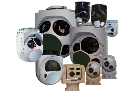
Turret Cameras
Turret cameras are specialized imaging systems designed for various applications, including intelligence, surveillance, and reconnaissance (ISR). These cameras are typically installed on aircraft, unmanned aerial systems (UAS), or other platforms to provide enhanced situational awareness and data collection capabilities. Turret cameras are characterized by their ability to rotate and tilt, allowing for flexible and precise imaging in multiple directions. They often incorporate a combination of electro-optical (EO) and infrared (IR) sensors, along with advanced features such as image stabilization, long-range capabilities, and target tracking. Turret cameras enable operators to capture high-resolution visual and thermal imagery, perform real-time surveillance, track targets, and support mission planning. They are utilized in military operations, law enforcement, border security, and other scenarios where detailed imaging, target acquisition, and situational awareness are critical. Turret cameras enhance the ISR capabilities of platforms, enabling effective data collection and analysis in a wide range of operational environments.

EO/IR Imaging Sensors
EO/IR (Electro-Optical/Infrared) sensors are imaging systems that combine optical and infrared technologies to capture visual and thermal information from the environment. EO sensors capture light in the visible spectrum and near-infrared range, similar to what the human eye perceives, providing detailed color and grayscale images. IR sensors detect and measure thermal radiation emitted by objects, enabling the visualization of heat signatures. EO/IR sensors are utilized in various applications such as surveillance, target identification, navigation, and reconnaissance. They are commonly used in military and defense operations, law enforcement, aviation, and maritime surveillance. These sensors enhance situational awareness, allowing operators to detect, track, and monitor targets day or night, regardless of lighting conditions. EO/IR sensors play a critical role in intelligence gathering, providing real-time visual and thermal data for decision-making processes and mission planning. By combining both optical and thermal imaging capabilities, EO/IR sensors provide comprehensive information for a wide range of applications in diverse environments.

LiDAR Sensors
LiDAR (Light Detection and Ranging) sensors are remote sensing devices that use laser light to measure distances and capture detailed 3D information about the environment. By emitting laser pulses and measuring their return time, LiDAR sensors can calculate precise distances to objects and create highly accurate 3D maps or point clouds of the surroundings. LiDAR sensors are utilized in various applications, including mapping and surveying, autonomous vehicles, environmental monitoring, infrastructure and construction, and archaeology. They play a crucial role in creating elevation models, assessing terrain, detecting and avoiding obstacles, monitoring vegetation health, analyzing building structures, and documenting cultural heritage sites. LiDAR sensors provide valuable data for research, planning, and decision-making processes, enabling efficient and accurate spatial analysis. With their ability to capture detailed and precise information, LiDAR sensors have become instrumental in numerous industries, revolutionizing the way we perceive and understand the physical world.
COMINT
COMINT (Communications Intelligence) systems are essential for intercepting, monitoring, and analyzing communication signals. These systems capture various forms of communication, including voice, data, and digital transmissions, to extract valuable intelligence. COMINT systems decipher encrypted messages, identify communication patterns, and provide insights into the content and participants of the communication. They are vital in military, defense, and intelligence operations, as well as law enforcement and cybersecurity. By understanding the intentions, capabilities, and activities of adversaries, COMINT systems support strategic planning, operational decision-making, and threat assessment. These systems continually evolve to adapt to advancements in communication technologies, ensuring their effectiveness in gathering critical intelligence.
ELINT
ELINT (Electronic Intelligence) systems are essential for intercepting, analyzing, and exploiting electronic emissions from radar systems, electronic warfare platforms, and other electronic devices. These systems detect and gather intelligence on electromagnetic signals emitted by these sources, providing insights into radar capabilities, electronic signatures, and potential threats. ELINT systems are crucial in military, defense, and intelligence operations, enabling the understanding of enemy radar systems and electronic warfare capabilities. By collecting and analyzing electronic emissions, ELINT systems support situational awareness, threat assessment, and operational decision-making. These systems continually adapt to evolving electronic technologies and new threat environments to provide accurate and timely intelligence.
SIGINT
SIGINT (Signals Intelligence) systems are instrumental in collecting, intercepting, and analyzing various types of signals to gather intelligence. These systems encompass both COMINT (Communications Intelligence) and ELINT (Electronic Intelligence) capabilities, targeting communication signals and electronic emissions. SIGINT systems intercept and analyze signals from a range of sources, including voice communications, data transmissions, radar systems, and electronic devices. By deciphering encrypted messages, identifying communication patterns, and understanding electronic emissions, SIGINT systems provide critical insights into enemy activities, capabilities, and intentions. These systems support military operations, intelligence gathering, cybersecurity, and national security efforts by providing actionable intelligence for strategic planning, threat assessment, and operational decision-making.